The headland walk: Knab Rock to Langland Bay
About 3.5km round the point from the prom to the beach huts at Langland, past the pier, Bracelet Bay and Limeslade, with the bus back and the one tide rule that matters.
This is the walk to do if you only have one afternoon in Mumbles. It starts where the prom ends at Knab Rock, goes round the headland past the pier and the lighthouse view, and finishes at the beach huts on Langland Bay, about three and a half kilometres measured between the points on our trail map. Allow an hour to an hour and a half one way at an easy pace, longer with stops, and plan to come back by bus.
Before you set off
Check the tide, and not because the path floods: it does not. The reason is the islands off Mumbles Head. At low water you can walk out across the rocks to them, and every year people misjudge the time and get cut off. Swansea Coastguard has dealt with groups stranded on Middle Head, and the Mumbles lifeboat has had to go and pick them up. Treat the islands as a view. If you see someone in trouble on the rocks or in the water, dial 999 and ask for the Coastguard.
Parking: Knab Rock car park at the start is Swansea Council pay and display with 112 spaces and public toilets, and the council's late-2025 tariff was £2.50 for an hour up to £17 for a day. Without a car, take the 3A or 2A bus from Swansea to Bracelet Bay and walk the first half backwards, or ride to Oystermouth Square and walk along the prom to Knab Rock in about fifteen minutes.
Knab Rock to the pier
Start at the slipway at Knab Rock. The Pilot, the 1849 pub that brews its own beer, is on the landward side of the road. The cafe on the seaward side is Verdi's, closed since a fire on 30 July 2026; its owners were aiming to reopen by Easter 2027. Walk south along Mumbles Road with the bay on your left. The road runs along the foot of Mumbles Hill to the pier, a little under a kilometre on. The pier opened in 1898 at the end of the Mumbles train and is Grade II listed. At the shore end are the amusements, the Beach Hut cafe and the Copperfish takeaway; the boathouse at the far end is the RNLI station that has been cut off from its slipway since 2023. Do not plan on walking out to it.
Round the point to Bracelet Bay
From the pier the road climbs round the corner. On the right, by the car park, is the Big Apple, a concrete kiosk shaped like an apple, built in the 1930s as a roadside advertisement and now a listed building. Below it is Bracelet Bay, a cove of pebbles and sand under limestone cliffs, and straight ahead are the two islands: Middle Head, and the outer island with the lighthouse, which was finished in 1794 and has run on solar power since 1995. This is the best place in Mumbles to see why the name is thought to come from the islands' shape. The glass building above the beach is The Lighthouse Bar & Kitchen, which was Castellamare until 2022, and is the place to shelter if the weather turns.
Limeslade and Rams Tor
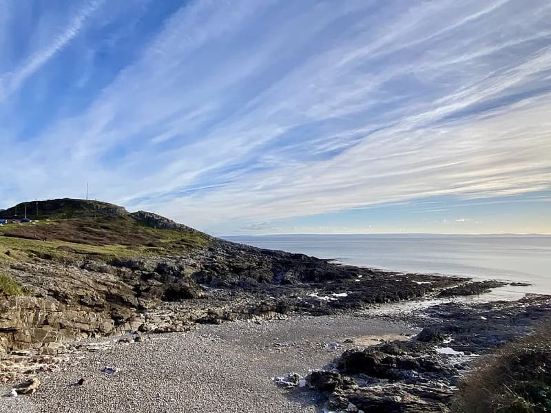
The path drops west into Limeslade, a small cove with Tutt Head and its coastguard lookout above it, then runs along the open coast below Rams Tor. This is the stretch where you notice the change: behind you is the sheltered bay, and in front is the open Bristol Channel. The path is above the rocks here, so keep children and dogs close.
Rotherslade to Langland
After Rams Tor the path comes down into Rotherslade, the cove locals sometimes call Little Langland, and then along the front to Langland Bay itself, with its rows of beach huts along the top of the beach. The oldest of the council's huts date from 1923. At the western end is Langland's Brasserie, open daily from ten, which does breakfast until eleven and seafood through the day. Inside tables are booked online; the terrace is first come, first served. This is the end of our trail.
Going on to Caswell
If you have more in your legs, the coast path carries on west from the far end of Langland along the cliffs to Caswell Bay, a sandy bay in the neighbouring community of Bishopston. It is a little over a kilometre further in a straight line and longer on the path. Caswell has a cafe, toilets and a beach that the council lifeguards in summer.
Getting back
From Langland, walk up to Langland Corner, where First Cymru's routes 1, 2 and 2A stop on the way back through the village to Swansea. From Caswell Bay, the route 1 terminus is by the car park; on the February 2026 weekday timetable it left Caswell at quarter to each hour from 10:45 to 17:45 and reached Oystermouth Square about twelve minutes later. Evening and Sunday buses are thinner, so check the timetable before you go.
When to do it
Any time of year. Westbound in the late afternoon is the best version, because you walk towards the sun setting over Langland. On a summer Saturday the Bracelet Bay car park and the Langland end are busy; on a clear winter morning you will have most of it to yourself apart from the dog walkers.
Keep Reading
Mumbles or Oystermouth? Names, words and the lifeboat
Why the buses say Oystermouth and everyone says Mumbles, where the name might come from, the local words worth knowing, and why the lifeboat matters here.
Food & DrinkIce cream, chips and seafood: eating along the Mumbles seafront
Joe's ice cream, where the Verdi's team went after the fire, fish and chips on the pier, lunch above Bracelet Bay and at Langland, and the pub that brews its own beer.
Planning a trip?
Explore restaurants, activities, accommodation, and more.