Walking the Doneraile and the Cliff Road to the coves
The 5km clifftop walk that runs west out of Tramore to the Guillamene and Newtown Cove, what you pass on the way, and where it stops being easy.
Most people who come to Tramore for the day never get past the prom. That is a fair use of an afternoon, but it means missing the walk that actually explains the place, and it is not a hard walk. Lord Doneraile laid it out in the early nineteenth century as a private promenade for his family and their friends, cut into the clifftop above the western end of the bay. It is public now, and Waterford City and County Council's heritage leaflet measures it at 5km and allows an hour and a quarter, which assumes you come back by the road rather than retracing your steps.
Where it starts
There are two sensible starting points. If you are already at the seafront, walk to the western end of the promenade and climb; the path picks up above the town. If you are driving, use the free car park off Doneraile Drive, which puts you on the walk itself and skips the climb. The Doneraile Drive car park is small and it does fill on a fine Sunday, but nothing like as fast as the promenade pay-and-display behind the beach.
The surface is mown grass and tarmac path, with no stiles and no gates. It is a walk you can do in runners. It is not, however, step free: the descent into Glenacuan and the steps down to the swimming coves at the far end both rule that out.
What you pass
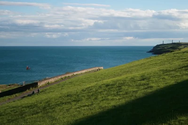
An old cannon sits near the start. Further along is the Sea Horse memorial, which commemorates the troop transport wrecked in the bay on 30 January 1816 with the loss of somewhere around 350 to 363 people, depending on which count you follow. The wreck is the reason for everything you can see out at the mouth of the bay: three white pillars on Great Newtown Head to your left as you face the sea, and two more on Brownstown Head across the water. On a clear day you can pick out both sets from the path, which is the single best thing about this walk.
Twenty minutes from the prom, or three from the Doneraile Drive car park, you reach the old coastguard station, a grey stone terrace with red brick dressings and a lookout tower, restored as the Coastguard Cultural Centre. There is a cafe, gallery spaces, a craft shop, and clifftop gardens that are free to walk into. It is open seven days, weekdays from nine and weekends and bank holidays from ten, both closing at half four, with lunch served from noon until four. Plan around it rather than past it; it is the natural halfway stop, and on a cold day it is the only shelter on the route.
Down to the coves
Past the centre the path drops into the dip at Glenacuan, then joins the Cliff Road, passing the pier and the RNLI lifeboat station. From there it is public road, narrow in places, so walk on the seaward side where you can see what is coming. Keep going south and you arrive at the Guillamene and, just beyond it, Newtown Cove.
These are the two rock coves the Newtown and Guillamene Swimming Club has run for more than seventy-five years. Concrete platform, steps, handrails straight down into deep water. Both hold Green Coast awards for 2026. There is no lifeguard at either, at any time of year, and the entry is deep water off the steps rather than a wade, so this is not a place to try swimming for the first time. On a south or southeast swell the sea comes over the platform and nobody sensible gets in.
The painted sign at the Guillamene still says Men Only. It was true until the early 1980s and it has been ignored ever since. Visitors photograph it; locals walk past it and get changed.
The return, and the extension
The straightforward return is up from Newtown Cove onto the Newtown road and back into town, which is what the council's 5km figure assumes. It is unremarkable walking but it gets you back in twenty-five minutes rather than retracing the cliff.
The other option is to keep going. From Newtown Cove the coast runs on south to Great Newtown Head, where the three pillars stand and the Metal Man is on top of the middle one, twelve feet of cast iron pointing away from the coast. This is open, unfenced clifftop on grazing land. There is no barrier at the edge, no path in the formal sense, and the drop is real, so keep well back, keep dogs on a lead and do not attempt it in a gale. There is no parking at the head itself. Park at Newtown Cove and walk.
Practicalities
Bring a windproof layer whatever the forecast says: the whole route is exposed and Tramore Bay faces south, so a light day in town can be a hard one on the cliff. Water is worth carrying, since the cafe at the coastguard station is the only place on the route to buy anything. Dogs are fine on the walk itself and should be on a lead near the cliff edge and at the coves.
If you are coming from Waterford without a car, the 360 bus drops in the town centre roughly every twenty minutes and carries on to Church Road, Cliff Road and Newtown Hill, so you can ride out to the far end and walk back into town. That is the version to do if the wind is behind you.
Keep Reading
Learning to surf in Tramore, and when to come back for the waves
Who teaches, what a lesson costs, why autumn beats summer for surf, and how to read Tramore strand before you get in.
History & CultureThe Metal Man, the Sea Horse, and the two things Tramore gets wrong
Five beacon towers, one twelve-foot cast-iron sailor, a wreck that killed hundreds, and a pair of stories about all of it that the documents do not support.
Planning a trip?
Explore restaurants, activities, accommodation, and more.