About Margate
The history, geography, and character of Margate.
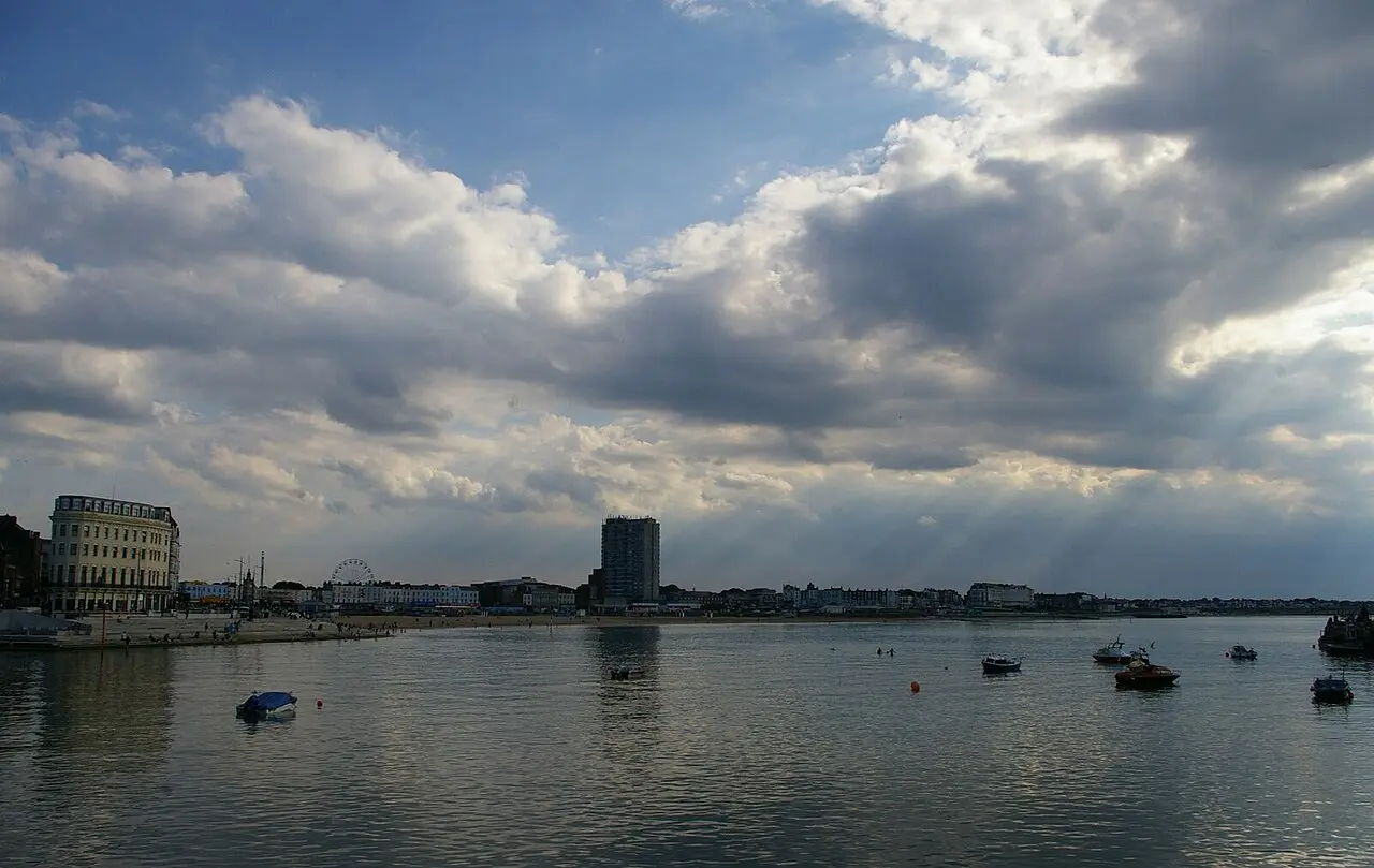
Margate occupies the north-east corner of the Isle of Thanet, the chalk block at the end of Kent that was a genuine island until the Wantsum Channel silted up in the late medieval period. The coast here faces north, which is the single geographical fact that explains most of the town: the sun sets over open water, the light is what brought JMW Turner back again and again, and the wind comes off the North Sea with nothing in the way. It was one of the first English sea-bathing resorts, it was the working Londoner's seaside for two centuries, it was written off for about forty years, and since 2011 it has been the subject of a long, loud, unfinished argument about what it is becoming. All of that is visible from the harbour wall at once.
History & Heritage
The island that stopped being one
Thanet was separated from the Kentish mainland by the Wantsum Channel, a navigable strait wide enough to carry shipping between the Thames Estuary and the Channel, avoiding the passage around the North Foreland. The channel silted progressively through the medieval period until it became marshland and then farmland, and the island became a peninsula. Locals still call it the Isle, and the name survives in everything from the Isle of Thanet News to the way people from Margate, Broadstairs and Ramsgate talk about the mainland. The underlying geology is chalk, and the whole character of the coast follows from it: white cliffs, sand rather than shingle beaches formed from eroded chalk and flint, and the free-standing sea stacks at Botany Bay. The chalk is soft and actively eroding, which is why the cliffs are fenced in places and why nobody should be sitting at the foot of them.
How a fishing town became a resort
Margate was an early adopter of sea bathing as a health practice rather than a pleasure, and it produced one of the specific inventions of that culture, the bathing machine, a wheeled hut that let bathers enter the water without being seen from the shore. The town grew Georgian squares and terraces on the back of it, of which Hawley Square survives as the clearest example. What turned a genteel resort into a mass one was transport: first the Thames sailing hoys and paddle steamers bringing Londoners down the estuary, then the railway. For most of the nineteenth and twentieth centuries Margate was where working London went for its holiday, and the town built itself around that, from the amusements on Marine Terrace to the enormous seafront hotels of Cliftonville. Cheap package flights to the Mediterranean took that trade away over the second half of the twentieth century, and Margate spent decades absorbing the consequences.
Turner, Eliot and the north-facing sky
JMW Turner was sent to school in Margate as a boy and returned repeatedly as an adult, lodging on the seafront at the spot where the gallery bearing his name now stands. He is quoted as saying the skies over the Isle of Thanet were the loveliest in all Europe, and the geography backs the claim: on a north-facing coast the sun sets over the sea rather than behind the land, so the town gets the full colour of it across open water. The other literary association is stranger and better documented than most such claims. T S Eliot came to Margate in the autumn of 1921 to recuperate after a breakdown, and in a letter that November described composing part of what became The Waste Land while sitting in a shelter on the front. The poem carries the line: On Margate Sands. I can connect Nothing with nothing. The Nayland Rock promenade shelter, built around 1900, was listed Grade II by Historic England in October 2009, and the list entry gives among its reasons for designation its special literary association as the likely location where Eliot composed part of the poem. Note the hedge in the official wording: likely, not certain.
The thing nobody can explain
In 1835 an underground passage and chamber lined with shell mosaic was found beneath what is now Grotto Hill. It runs to around 2,000 square feet of mosaic and roughly 4.6 million shells along about 70 feet of tunnel, and no one has ever established who built it, when, or for what. The Grotto's own account is blunt about this: its discovery came as a complete surprise to the people of Margate, and debate has raged about its origins ever since. Candidate explanations have included a Regency garden folly, a smugglers' store, an eighteenth-century gentleman's grotto in the fashionable style, and something considerably older, and the evidence has never settled on any of them. Dating shell mortar is difficult, the site was cleaned and lit with gas early in its visitor career, and the documentary trail before 1835 is simply absent. It is Grade I listed. It is worth resisting the pull towards an answer, because the honest position, that a substantial decorated structure exists under a residential street in Margate and nobody knows why, is more interesting than any of the theories.
Dreamland, decline and the long gap
The amusement park on Marine Terrace has operated under various names since the early twentieth century, and its Scenic Railway, opened in 1920 and the oldest surviving roller coaster in Britain, is a Grade II* listed structure. The park closed in the mid-2000s, and in 2008 the Scenic Railway was badly damaged by an arson attack, which for a while looked like the end of it. It was not: the coaster was rebuilt and the park reopened as a heritage amusement park, deliberately vintage in character, and it now operates free to enter with rides paid for individually. The coaster itself has since stopped, which is the ending most accounts have not caught up with. It last ran in August 2024, when a carriage fault ripped planks out of the track, and in January 2026 Dreamland said it had completed its journey as a roller coaster and would take retirement from operation as a ride. The Health and Safety Executive had advised that keeping it in service would need a daily inspection routine; Dreamland told the council its engineers put that at up to five hours every day and that it was not viable. The structure is listed and stays, and the park is committed to it remaining a feature, but it is no longer something you queue for. The gap between the closure and the reopening is the part of Margate's story that gets compressed in most accounts, and it was not brief. Cliftonville's large seafront hotels were converted to houses in multiple occupation, the town absorbed significant social pressure, and Thanet has carried some of the highest deprivation indicators in the south-east of England throughout the period.
What changed after 2011
Turner Contemporary opened in 2011, Dreamland reopened, the Old Town filled with independents, and Margate acquired a reputation as the coastal town Londoners move to. The people who moved are known locally, not always affectionately, as DFLs: Down From London. Regeneration here has been uneven, and it is not finished.
How the town is laid out
Practically, Margate is four places. The seafront runs from the railway station east past Dreamland and Marine Terrace to Main Sands and the harbour, and it is flat, wide and continuous, the best walking in the town. The Old Town is the tight grid of lanes immediately behind the harbour, centred on Market Place, and it holds most of the independents, galleries and small restaurants. Behind that, on the rise, sit the Georgian squares, Hawley Square chief among them, and the High Street. Then the ground climbs east to Cliftonville, a separate Victorian and Edwardian resort suburb of large terraces and seafront hotels, with Northdown Road as its spine and the bays and the Walpole Bay tidal pool below it. Everything named in this guide sits within about a mile and a quarter of the harbour except Botany Bay, which is about two and a half miles east, three on foot along the coast, and administratively in Broadstairs.
Wildlife & Nature
Marine Life
Harbour and grey seals
Seals are seen off the Thanet coast and in the wider Thames Estuary, whose seal population has recovered substantially from a very low base. Sightings from the Margate shoreline are occasional rather than reliable, and the sandbanks offshore rather than the beaches are where they haul out. Treat any seal on a beach as resting rather than in distress and keep well back; report a genuinely injured animal to the relevant rescue service rather than approaching it.
Year-round, opportunistically, most often from the Harbour Arm or the clifftop path with the sea calm
Chalk reef and rock pool life
The chalk platform exposed at low tide along the Thanet bays is a nationally significant habitat, and the coast here carries conservation designations for it. What you actually see in the pools between Walpole Bay and Botany Bay at low water is anemones, shore crabs, prawns, limpets and periwinkles, with seaweeds anchored to the chalk. The Walpole Bay tidal pool itself holds a good deal of this life because it retains water when the rest of the platform drains. Look, do not collect, and put back anything you turn over exactly as you found it.
Low tide, and particularly on a spring tide. Check a tide table before setting out.
Birdlife
Turnstones and shoreline waders
Turnstones work the tideline and the harbour wall in small busy groups, flipping weed and stones for invertebrates, and they are the bird you will most reliably see on a Margate beach without looking for one. Oystercatchers, sanderling and ringed plover use the bays too, with numbers rising through autumn and winter as migrants arrive. The Harbour Arm and the exposed chalk platform at low tide are the best places to stand still and watch.
Autumn and winter for the largest numbers; low tide at any season
Fulmars and cliff-nesting gulls
The chalk cliffs east of Margate towards Foreness Point and Botany Bay hold nesting birds on their ledges through the spring and summer, fulmars among them, alongside the herring gulls that are a permanent and vocal feature of the town itself. Margate's urban gulls are bold and will take food from a hand on the seafront, which is a nuisance rather than a wildlife experience; the cliff birds are the ones worth stopping for. Watch from the clifftop path rather than from below.
Spring and early summer for nesting activity on the cliff ledges
Flora
Chalk cliff-top grassland
The strips of unimproved grassland along the Thanet clifftops sit on thin soil over chalk, which suppresses vigorous grasses and lets a specialised flora hold on: low-growing herbs, vetches and, in the right spots, wild orchids. It is a scarce habitat squeezed between the cliff edge and the promenade, and it is easily damaged by trampling. Stay on the path, which is also the sensible advice for an eroding chalk edge.
Late spring and early summer, when the flowering is at its peak