Ben Nevis by the Mountain Track
About 16 km to the summit and back from the visitor centre (High Life Highland) · Summit 1,345 m (Ordnance Survey resurvey, 2016) elevation
About
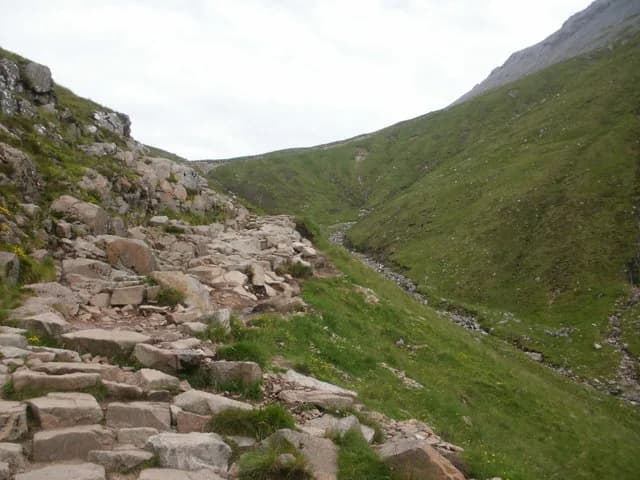
Ben Nevis is 1,345 metres high on the Ordnance Survey's 2016 resurvey, and the John Muir Trust, which looks after the upper mountain, says over 130,000 people climb to the summit each year. Almost all of them use the Mountain Track, which Mountaineering Scotland notes was previously known as the Tourist Route and which starts at the Ben Nevis Visitor Centre in Glen Nevis. The Ben Nevis Inn at Achintee and Glen Nevis Youth Hostel both describe themselves as at the foot of the path. High Life Highland, which runs the visitor centre, puts the round trip at about 16 kilometres and an average of seven to eight hours; Mountaineering Scotland says six to nine. Mountaineering Scotland calls it a demanding walk. Mountaineering Scotland says even in summer the summit and higher slopes can be very cold, wet, windy and covered in snow, that the summit sits on the edge of cliffs with steep gullies either side of the way down, and that there is no cafe or shop at the top. High Life Highland adds that there are no toilets or litter bins on the mountain, and that navigating with a map and compass is essential in poor visibility. Do not follow a phone map's line up the hill: in 2021 Mountaineering Scotland and the John Muir Trust warned that Google Maps showed a dotted line to the summit across pathless steep ground, which they called potentially fatal.
Highlights
- ✓The summit of Ben Nevis, 1,345 m
- ✓The Halfway Lochan, Lochan Meall an t-Suidhe
- ✓The zigzags on the upper mountain
- ✓Views back over Glen Nevis on a clear day
Tips
- →Check the Met Office five-day forecast for Ben Nevis and the MWIS West Highlands forecast before you set off; both are recommended by Mountaineering Scotland. In winter, read the SAIS Lochaber avalanche report too.
- →Carry warm, windproof and waterproof clothing including a hat and gloves, boots with ankle support, a torch, a first aid kit, an emergency shelter and at least two litres of fluid, per Mountaineering Scotland. It advises against cotton such as jeans and T-shirts.
- →Mountaineering Scotland publishes the bearings off the summit plateau in poor visibility (from the summit cairn, 150 metres on 231 degrees, then 282 degrees, keeping clear of Gardyloo Gully and Five Finger Gully). Read its page and practise with a map and compass before you need them.
- →The visitor centre car park is £8 a day and first come, first served, per High Life Highland. Get there early in summer.
- →In an emergency call 999 and ask for Police, then Mountain Rescue, as Scottish Mountain Rescue advises.