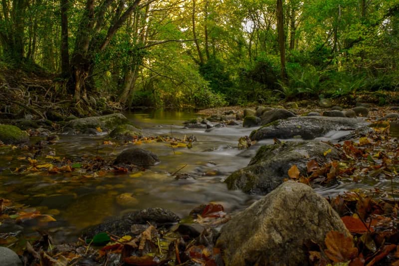
Walking out of Enniskerry: the wood, the ridge and the free waterfall view
Enniskerry has four walks worth the trip and they range from an hour in a river ravine below the houses to a strenuous mountain loop. Here is which one fits your day, and what each actually asks of you.
Enniskerry gets treated as a car park with a coffee shop attached, a place you pass through on the way up to Powerscourt. That is a waste, because the village sits in a hollow with hills and rivers on every side, and the walking out of it ranges from an hour in a wooded ravine to a genuinely strenuous mountain loop. Four of them are worth your time, and they do not ask the same things of you at all.
An hour: Knocksink Wood
Start with the one that begins at the bottom of the village. Knocksink Wood fills the ravine of the Glencullen River immediately below Enniskerry, ten minutes on foot down from the Square, and it became a statutory nature reserve in 1994. It runs to about fifty-two hectares, roughly 129 acres, of steep-sided river valley: sessile oak on the drier slopes, wet mixed woodland lower down, and an unusual scatter of springs and seepages including petrifying springs, which are a priority habitat under the EU Habitats Directive. It carries one of the most diverse woodland invertebrate faunas recorded in Ireland.
What that means in practice is a proper wild wood five minutes from a village square. Paths and boardwalk sections follow the river, the valley sides are steep enough to make you work, and after rain it turns properly muddy. Wear boots. There are no facilities of any kind: the old education centre closed years ago and has not reopened, so there is no toilet, no kiosk and no ranger. Parking at the wood is very limited, which is another argument for walking down from the village rather than driving.
An hour and a half: the Great Sugar Loaf
The cone on every horizon here is the Great Sugar Loaf, 501 metres, and despite the shape it is not a volcano. It is Cambrian quartzite of the Bray Head Formation, hard rock that outlasted everything softer around it. The Powerscourt gardeners knew what they had and framed it deliberately at the end of the Italian terraces, which is why it appears in most photographs of the gardens.
The standard climb does not start in Enniskerry. Drive about six kilometres to the car park on Red Lane, the L1031, on the southern side of the hill. From there it is a 3.5km round trip with about 210 metres of ascent, an hour to an hour and a half, and it finishes with a short hands-on scramble up a rocky gully to the summit. The return on effort is the best in north Wicklow: Bray Head and the sea, Little Sugar Loaf below you, the Wicklow Mountains behind and the Powerscourt demesne spread out to the northwest. It is exposed the whole way, with no shelter anywhere, so check the forecast rather than the view from the car. There is also a longer waymarked route, the 4.5km Sugar Loaf Way, which starts at Kilmacanogue and comes at the hill through lanes and an old coach road.
Two and a half hours: Crone Woods and Maulin
This is the serious one, and the one that gives you Powerscourt Waterfall for nothing. From the Crone Wood car park, about seven kilometres southwest of the village, a forest road climbs through conifer plantation and joins the Wicklow Way. Follow it to Ride Rock, the shoulder that looks straight across the valley at the falls from above, with the Great Sugar Loaf to the east and Dublin Bay behind on a clear day. The loop then leaves the Way, climbs onto the open ground of Maulin above the Glencree valley, and drops back into the forest.
Sport Ireland grades it strenuous: 6.6km, about 350 metres of ascent, roughly two and a half hours, waymarked with arrows on a red disc with footprints. Do not be lulled by the first twenty minutes. The lower half is gravel forest road and feels like a stroll; the upper half is open mountain with no shelter and rough, wet ground. Take a waterproof even on a bright morning. Dogs are allowed on a lead, and there is sheep grazing on the open section, so that lead is not optional. The Crone car park is small and fills on fine weekends.
Where the Wicklow Way actually goes
People assume the Wicklow Way runs through Enniskerry. It does not. It passes roughly four kilometres south of the village, through Knockree and on past Crone Wood, which is why the Crone loop can borrow a section of it. If you are walking the Way and want a night indoors, Enniskerry is the obvious diversion: there are rooms above the pub on Church Hill, food served through the afternoon, a pharmacy, a post office and an hourly bus to Bray station. Very few villages on that side of the mountains give you all of that.
The practical bit
None of these four walks has a bus to its trailhead except Knocksink, which you reach on foot. Crone Wood, the Sugar Loaf car park and the waterfall all need a car, a bike or a pre-booked taxi from the village, and mobile coverage on the higher ground is patchy enough that you should arrange a pick-up before you set out rather than after. Boots for Knocksink and Crone; anything with grip for the Sugar Loaf gully. And the standard Wicklow rule applies on all of them, which is that the weather on the tops is a different proposition from the weather on the Square.
Keep Reading
Powerscourt House or Powerscourt Waterfall? The seven kilometres nobody mentions
The most common planning mistake at Enniskerry is assuming Powerscourt is one place. It is two, with two entrances, two tickets and seven kilometres of road between them. Here is how to plan around it.
Food & DrinkEating in Enniskerry, and what is actually open when
A village of two thousand people has a small number of places to eat and a very particular rhythm. What opens at seven, what closes at five, what only does dinner, and what to do about the gap in between.
Planning a trip?
Explore restaurants, activities, accommodation, and more.