About Drogheda
The history, geography, and character of Drogheda.
Drogheda is the largest town in Ireland by population, with 44,135 people counted in the 2022 census, and it sits at the last bridging point on the River Boyne before the river reaches the Irish Sea. That single fact explains almost everything about the place. The Irish name, Droichead Atha, means the bridge of the ford, and the town grew up around the crossing rather than beside it. It was founded as two separate towns on opposite banks, Drogheda in Meath to the south and Drogheda in Oriel to the north, each with its own charter, and they were not united until 1412, when the combined town became a county corporate in its own right. The river still marks a boundary: the archdiocese of Armagh runs to the north bank and the diocese of Meath to the south, and the county line means about 8,145 of the town's people were counted in Co. Meath and 35,990 in Co. Louth. Locals shorten the name to something close to Drawda, which is why the town's mural trail is spelled that way.
History & Heritage
A town on two banks
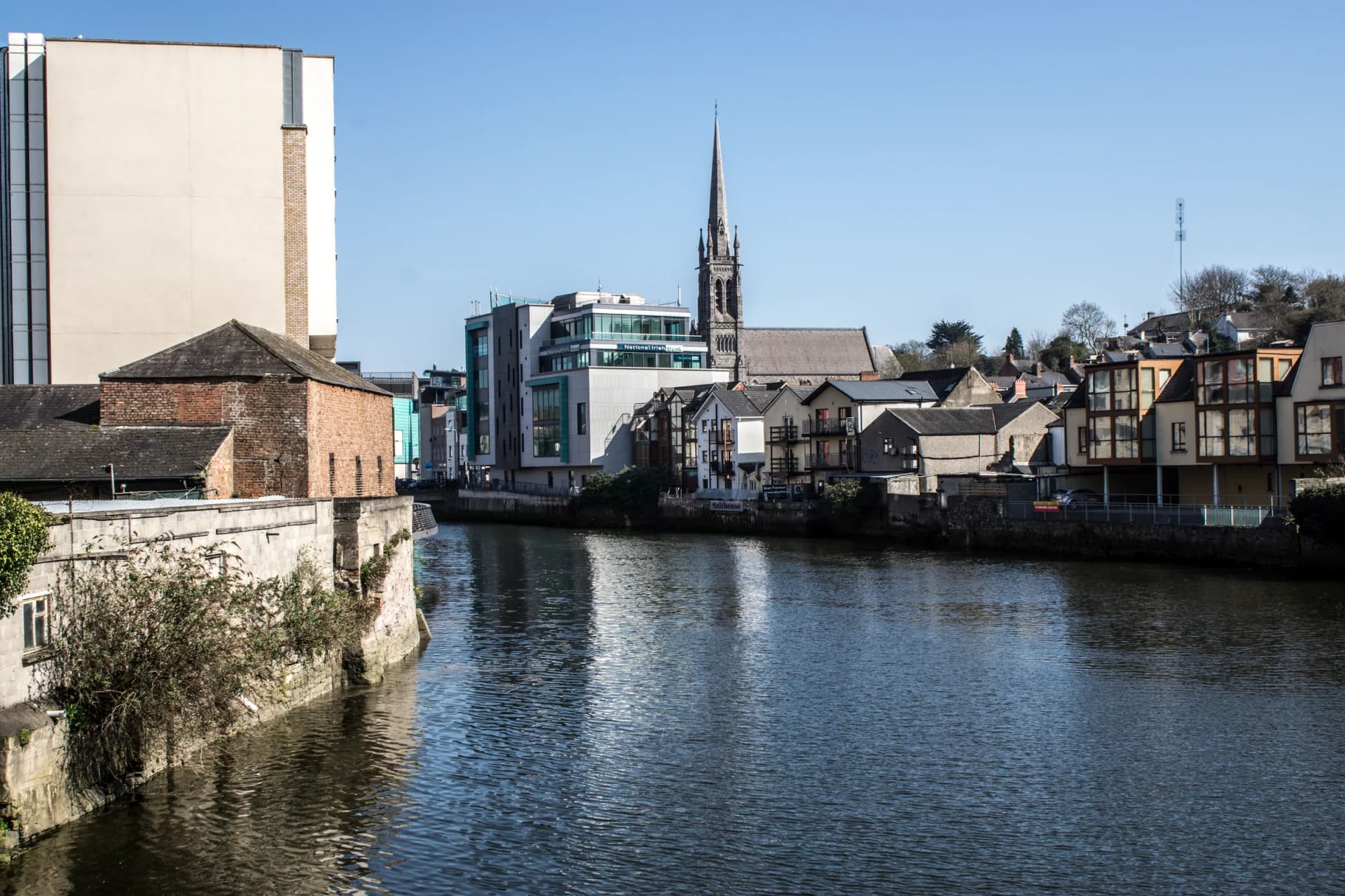
Drogheda's geography is the first thing to get straight. The Boyne runs west to east through the middle of it, the town centre and the main shopping streets are on the north bank, and the railway station, the bus station, Scotch Hall and Millmount are all on the south. The two sides are linked by a small number of bridges, which is why traffic bunches and why the sensible move as a visitor is to park once and cross on foot. Millmount, the great mound with the Martello tower on top, sits above the south bank and looks straight down the river. It is the natural orientation point: stand up there and the whole shape of the town, the quays, the spires on the north side and the viaduct downriver, resolves in one view.
The medieval walled town
Drogheda was one of the largest walled towns in medieval Ireland and enough of it survives to be worth walking. St Laurence's Gate, the barbican at the eastern end of St Laurence Street, is the finest piece: two great drum towers and a linking arch, built in the 13th century, with the street originally called East Street and the gate East Gate before the name of the nearby hospital of St Laurence attached to both. Magdalene Tower, the 14th-century belfry of the Dominican friary, still stands on the high ground to the north. The Butter Gate survives below Millmount. The Tholsel, completed in 1770, sits at the junction of West Street and Shop Street and now houses the tourist office. Drogheda is a member of the Irish Walled Towns Network, and a group of local people mapped four walking routes through the town, from a 1.5km Five Bridges walk to a 6.5km Steps walk, with a free map available around the town.
1649 and 1690
Two dates sit heavily on this stretch of the Boyne. In 1649 Cromwell's army stormed Drogheda after a siege, and the killing that followed, of the garrison and of townspeople, is one of the most bitterly remembered episodes in Irish history. The defenders' last stand was at Millmount. The tower of St Peter's Church of Ireland burned with people inside it. Forty-one years later, on 1 July 1690 by the old calendar, William III and James II fought at Oldbridge a few kilometres upriver, 36,000 men against 25,000, the largest force ever put on an Irish battlefield, and the result shaped the next three centuries here. The battle site is now an OPW visitor centre in the grounds of Oldbridge House, in Co. Meath. Both stories are told plainly in Drogheda rather than avoided, and both are worth understanding before you walk the town.
A working port and a brewing town
Drogheda is not a heritage town that happens to have a river. It is a working port, and the quays downstream of the town centre still handle cargo; Drogheda Harbour Commissioners were established in 1790 and the port company that succeeded them in 1997 still runs it. The industrial story is real too. The town brewed and distilled: Cairnes beer, Preston's whiskey and Dan Kelly's cider were Drogheda names, and at various points the town has bottled Guinness and Jameson and made Coca-Cola concentrate. The Boyne Viaduct, designed by Sir John MacNeill to carry the Dublin to Belfast railway across the river, went up in the 1850s and had its three river spans rebuilt in iron in 1932; it still dominates the view downriver. Today's bigger employers include the port, Coca-Cola, State Street and Glanbia, and the distilling tradition is back with Boann on the Platin Road at the town's edge.
The gateway to the Boyne Valley
Everything upriver is why a lot of people come. The Bru na Boinne passage tombs at Newgrange, Knowth and Dowth were built around 3200 BC inside a bend of the Boyne roughly 7km west of the town, in Co. Meath. Mellifont Abbey, Ireland's first Cistercian foundation, is about 8km northwest, in Co. Louth. Monasterboice, with Muiredach's High Cross and its round tower, is a similar distance north, also in Louth. It is worth being precise about counties here, because the Boyne Valley spans Louth and Meath and tourism copy conflates them constantly. It is also worth being precise about access: Newgrange cannot be driven to. Every visit runs through the Bru na Boinne Visitor Centre at Donore, by shuttle bus and guided tour, with tickets booked in advance. Drogheda, with a railway station and a run of places to eat and sleep, makes a better base for all of it than Dublin does.
Wildlife & Nature
Marine Life
Boyne Estuary waterbirds
The Boyne Estuary below the town is a Special Protection Area and a Special Area of Conservation, and the mudflats and channels downstream of Drogheda carry significant numbers of wintering and passage waterbirds. The conservation status of the estuary is not decorative: BirdWatch Ireland's concerns about the effect on migrating birds were part of why the proposed Drogheda to Mornington greenway was refused planning permission in 2023.
Autumn and winter, on a falling tide
Atlantic salmon in the Boyne
The Boyne is a salmon river, and the fish that gave the Salmon of Knowledge its name in the Fionn MacCumhaill story is the Boyne salmon. The mural of Fionn and the salmon on Dyer Street is part of the DRAWDA trail for exactly that reason. The river through the town is tidal, so what you are looking at from the quays changes character twice a day.
Late spring into summer
Birdlife
Gulls and terns at the port
The working quays and the estuary mouth downstream hold gulls year round and terns on passage through the summer, and the port and the river mouth at Mornington are the places to look rather than the town centre quays.
Summer for terns, all year for gulls
Flora
Alluvial and marsh woodland along the Boyne
The wet woodland along the Boyne within the Special Area of Conservation is scarce habitat and is studied locally; Highlanes Gallery has run public talks on the marsh and alluvial woodlands of the Boyne SAC as part of its programme, which is a good way in for anyone who wants to understand what is growing along the banks.
Late spring and early summer