Walking and cycling out of Carlingford: the greenway, Slieve Foye and the Tain Way
Three routes leave this village: a flat lough-shore greenway anyone can do, a strenuous waymarked mountain loop, and a two-day circuit of Carlingford Mountain. Here is how to pick.
Three waymarked routes start in or beside Carlingford, and they are about as different from each other as three routes from one village can be. One is flat and sealed and suits a buggy. One is a strenuous mountain loop that most people underestimate. One takes two days. Picking correctly is most of the work.
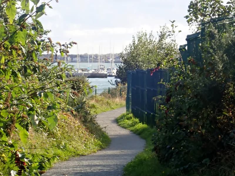
The Carlingford Lough Greenway
This is the easy one, and it is genuinely good. From Carlingford Marina the greenway runs north along the shore of the lough to the pier in the centre of Omeath, about 6.5 to 7km one way, on a sealed and mostly flat surface with one short section of around 300 metres on a public road. Walking it takes roughly two to two and a half hours each way; on a bike it is under an hour. It follows the alignment of the Dundalk, Newry and Greenore Railway, which ran through Carlingford from 1876 until 1951 and is the reason the village had a Victorian tourist trade in the first place. The village has effectively got its railway back as a footpath.
Beyond Omeath the route carries on to the national border and through Victoria Lock to Newry, making a cross-border corridor of roughly 19 to 20km, completed in 2025. Understand what that means before you set off: Newry is in the United Kingdom, so a full end-to-end run crosses an international boundary, with a different currency and a different mobile network at the far end.
Two practical notes. Start at the marina, not in the village: the first 1.3km from Carlingford to the marina is on the road, and it is the least pleasant part of the day. And OnYerBike hire bikes at the marina end, which is the sensible way to reach Omeath and get back with time to spare. Book ahead at weekends and in school holidays. The limiting factor out there is wind off the lough far more often than it is rain.
The Slieve Foye Loop
The waymarked loop starts at the tourist office and harbour car park in the village and is graded strenuous by Sport Ireland: 9.8km, about 270 metres of ascent, and roughly two and a half hours. Waymarking is a blue arrow on a white background. It climbs south out of the village, works up through forestry and along the forest edge, traverses open mountain, and comes back down into Carlingford. The surface changes constantly between tarmac, forestry road, grassy track and mountain path, and there is one rough section that holds water and turns boggy after rain.
What it delivers is the view: north along the coast, south along the coast, and out across Carlingford Lough to the mountains on the far shore, with the Isle of Man visible in genuinely clear conditions. What it does not do, and this catches people out, is take in the summit of Slieve Foye itself. The mountain runs to around 590 metres and is the highest point in County Louth, but the summit sits higher and further west than the waymarked route goes; reaching it is a separate and harder undertaking off the trail. If someone tells you they walked up Slieve Foye in two and a half hours from the village, they probably walked the loop.
Boots rather than trainers. Dogs are not permitted on this trail. Storm damage and diversions have been in place, so check Sport Ireland's trail page before you set out rather than after.
The Tain Way
The Tain Way is the long one: a waymarked circuit of roughly 40km around Carlingford Mountain on the Cooley Peninsula, with about 1,025 metres of cumulative ascent, starting and finishing in Carlingford and normally walked over two days. Waymarking is a yellow arrow on a black background. It is graded moderate rather than strenuous, but be clear-eyed about what it is: about 21km of it, a little over half, runs on quiet local roads rather than on mountain path, so it is a long-distance walk with plenty of tarmac in it. The route is managed from the tourist office in Carlingford.
The name is not decoration. This peninsula is the Cuailnge of the Tain Bo Cuailnge, the cattle raid at the centre of the Ulster Cycle, in which Queen Medb comes for the brown bull of Cooley. The route passes passage graves, portal tombs and Bronze Age cairns, and the views run north to the far shore and south along the coast. Dogs are not permitted on farmland along the way.
Choosing
If you have small children, a buggy, a wheelchair or two spare hours, take the greenway. If you have half a day, boots and reasonable fitness, take the Slieve Foye Loop and start early. If you have two days and want the peninsula rather than the village, walk the Tain Way and book a bed at the halfway point before you commit. All three start within 1.5km of the same car park, which is a genuinely unusual thing for a village this small.
Keep Reading
Medieval Carlingford: what survives, and what you can actually go inside
Carlingford has more standing medieval fabric than almost any Irish village its size. Here is what each building is, which ones you can enter, and which are a look from the street.
Food & DrinkEating and drinking in Carlingford: oysters, early last orders and a village with two speeds
A small village with a serious oyster and a short list of kitchens. What to eat, where, and why the day of the week matters more here than in most Irish towns.
Planning a trip?
Explore restaurants, activities, accommodation, and more.