The Bath Skyline
9.6km (6 miles) circular · Around 190m of ascent in stages; steps and steep sections elevation
About
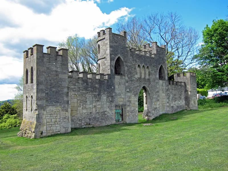
The best free thing in Bath: a six-mile (9.6km) waymarked National Trust loop through the meadows, beech woods and hidden valleys on the hills immediately above the city, with the whole World Heritage Site laid out below at intervals. The closest entry from the centre is Bathwick Fields, under a mile from the Abbey up Bathwick Hill, and yellow Bath Skyline arrows mark the way round. En route: Sham Castle, Ralph Allen's 1762 folly facade built purely to decorate the view from his town house; Iron Age and Roman traces on Bathampton Down; and the high pastures above Prior Park. There are steps, stiles, mud in winter and grazing cattle in places, so wear real shoes; a gentler two-mile waymarked circuit around Claverton Down offers a shorter, flatter alternative. Full route notes are in the Trails section.
Highlights
- ✓Panoramas over the whole Georgian city in its green bowl
- ✓Sham Castle, Ralph Allen's 1762 eye-catcher folly
- ✓Beech woods and wildflower meadows
- ✓Free and open year-round, waymarked with yellow arrows
Tips
- →Start at Bathwick Fields for the fastest reward-to-effort ratio from the centre.
- →Boots in winter: the clay slopes get properly muddy.
- →Cattle and sheep graze sections; keep dogs on leads where signed.
- →No National Trust car parks on the route; walk up from town or use the bus.