About Carlow
The history, geography, and character of Carlow.
Carlow, Ceatharlach in Irish and KAR-loh to anyone who lives here, is the county town of Co. Carlow and, with 27,351 people at the 2022 census, the twelfth-largest urban centre in Ireland. It is a crossing-point town on the River Barrow, eighty-odd kilometres south-west of Dublin, with a Norman castle on the riverbank, a cathedral and a college on College Street, an arts centre beside them, and a main street, Tullow Street, that does most of the town's eating and drinking. It is not a postcard town and does not try to be one. It is a working county town that happens to have more history standing in it than the traffic on the Kilkenny Road suggests.
History & Heritage
A town on the Barrow
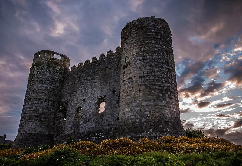
The Barrow is the reason Carlow is where it is. William Marshal, Lord of Leinster, built his castle at the meeting of the Barrow and the Burrin between about 1208 and 1213 to hold the crossing, and the Office of Public Works counts it among a small group of four-towered keeps that includes Ferns and the first castle at Kilkenny. For a few years in the fourteenth century the Irish Exchequer worked out of it. The river is also the old boundary between Co. Carlow and Co. Laois: the Local Government Act of 1898 put the whole of the town into Co. Carlow, but the west bank beyond it, Graiguecullen, is still Co. Laois in places, and so is the Talbot Hotel on the Portlaoise Road. Graiguecullen Bridge, the crossing between the two, has a recorded date of 1569 and was largely rebuilt and widened in 1815, when it was named Wellington Bridge after Waterloo.
The castle a doctor blew up
Carlow Castle came through changes of owner, the Crown's confiscation in 1537 and Cromwell's army in 1650, and then it met Dr Philip Parry Middleton. Granted the castle in 1814, he wanted to turn it into a lunatic asylum and, to clear the vaulted interior faster, set blasting powder at its base. The eastern half collapsed. Lord Walter Fitzgerald, writing in the Carlow Sentinel in 1904, put it down to ignorance and folly. What stands now, the west wall and two towers, is a National Monument in OPW care. It was reopened to the public in October 2021 after works, with fencing to keep visitors back from parts of the walls.
1798 and the Liberty Tree
The worst day in the town's history came in 1798, when the United Irishmen attacked Carlow and were beaten back, and the killing that followed is put at around six hundred rebels and civilians. The dead were buried in what is still called the Croppies' Grave, on '98 Street in Graiguecullen. The town's memorial is the Liberty Tree, a bronze sculpture by John Behan that stands on the roundabout where Kennedy Avenue meets the Potato Market.
College Street and the Cultural Quarter
College Street is the town's best street for an hour's walk. The Cathedral of the Assumption, designed by Thomas Cobden, was completed in 1833. St Patrick's College beside it dates from the 1790s and is now Carlow College, St Patrick's. In its grounds is VISUAL, the contemporary art centre and theatre that hosts the Carlow Arts Festival, and across the road the old Presentation convent now holds the county library, the tourist office and Carlow County Museum, which is free. Carlow Tourism and the town's hotels call this the Cultural Quarter.
Sugar, a scientist and electric light
Three things from the last two centuries explain a lot about the town. When the Irish Free State decided to open a sugar beet factory in Leinster, it chose Carlow for its rail links and its farmland, and the factory ran for almost eighty years; the county museum has a room on it. John Tyndall, the nineteenth-century scientist the museum credits with discovering the greenhouse effect, was a Carlow man, and a sculpture in the town, Sky Rivers, is named as a homage to him. And in the 1890s Milford Mills, about seven kilometres down the Barrow, generated the electricity that first lit Carlow's streets; the mill still produces power.
What is out of town
Two of the best things to see in the Carlow area need a car or a taxi. Brownshill Dolmen, a little over three kilometres east of the town centre on the R726 Hacketstown road, is a Neolithic portal tomb whose granite capstone Carlow Tourism puts at over 100 tonnes. Duckett's Grove, north-east of town, is the Gothic shell of a big house that burned in 1933, now a free council park with two restored walled gardens. Further south the county becomes the Barrow valley proper, Leighlinbridge, Bagenalstown and Borris, with the Blackstairs Mountains behind; those are separate places and are named as such on this site.
Wildlife & Nature
Birdlife
Mute swan
Mute swans live on the Barrow in the middle of town and are easy to see from the riverside near the castle and Graiguecullen Bridge.
Year round
Grey heron
Carlow Tourism describes the Milford stretch of the Barrow as a place for regular sightings of herons and kingfishers, and herons are the easier of the two to spot, standing on the weirs and in the shallows.
Early morning, year round
Kingfisher
The Barrow at Milford is one of the places Carlow Tourism names for kingfishers. Look low over the water near the weir and the side channels; you will usually see a flash of blue rather than a bird sitting still.
Spring and summer
Flora
Towpath hedgerows
Waterways Ireland's notes for the Carlow to Leighlinbridge stretch list hedgerows of bramble, blackthorn and elder along the towpath near Clogrennan, and willow and alder further south.
Late spring for blossom, late summer for blackberries